Douro Valley Map: The Sub-Regions And How To Read Them
The Douro is longer and more spread out than a photo of one river bend suggests. Understand the three sub-regions and the distances, and the whole trip stops feeling like guesswork.
Turn the map into one workable day by choosing a Porto departure or an experience that starts in the valley. Explore Douro Valley Small Group Tour: 2 Wineries, Lunch & River Cruise
 Written with Niko Stavros, Douro Valley wine tourism specialist
Short answer
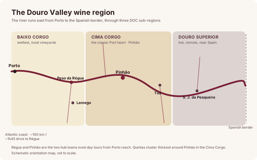
The Douro wine region runs east up the river from near Porto to the Spanish border, split into three sub-regions: Baixo Corgo around Peso da Regua (closest to Porto, about 90 minutes), Cima Corgo around Pinhao (about 2 hours, where most famous quintas cluster), and Douro Superior beyond, the hottest and least visited. Lamego sits just south of Regua, and Tua lies upriver of Pinhao at a river confluence. Most day trips concentrate on Regua and Pinhao.
Porto tours connect the central valley without separate transfers. Pinhão boat tickets start at the local quay, not Porto. Explore Douro Valley Small Group Tour: 2 Wineries, Lunch & River Cruise
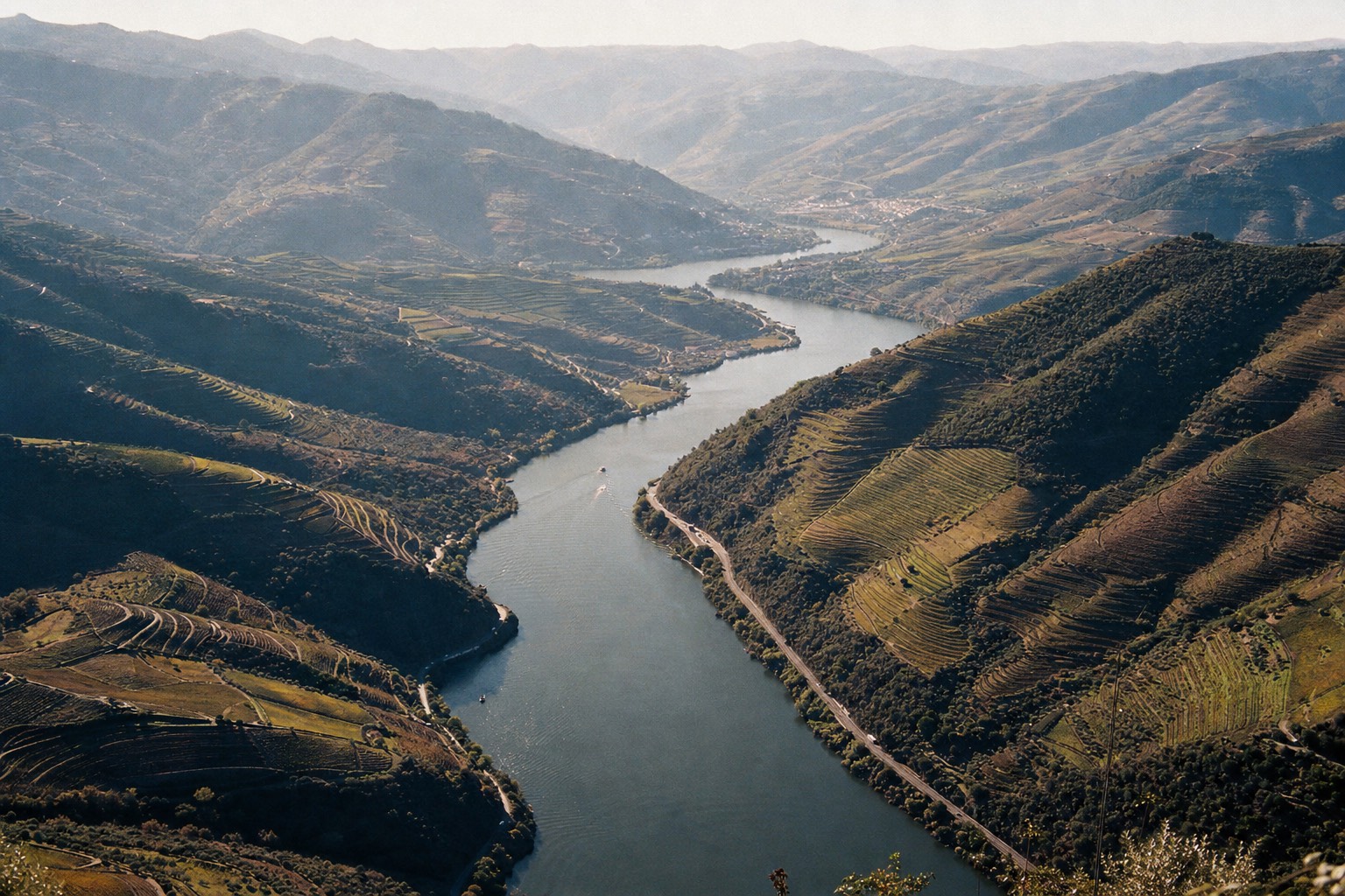
People ask me for a Douro map expecting a single town with vineyards around it. The valley is not that. It is a river region that runs east for well over a hundred kilometres, changing climate and character as it goes, and knowing which part you are aiming at is the difference between a relaxed day and a lot of unexpected driving. Here is the whole layout in plain terms.
What Are The Three Sub-Regions Of The Douro Valley?
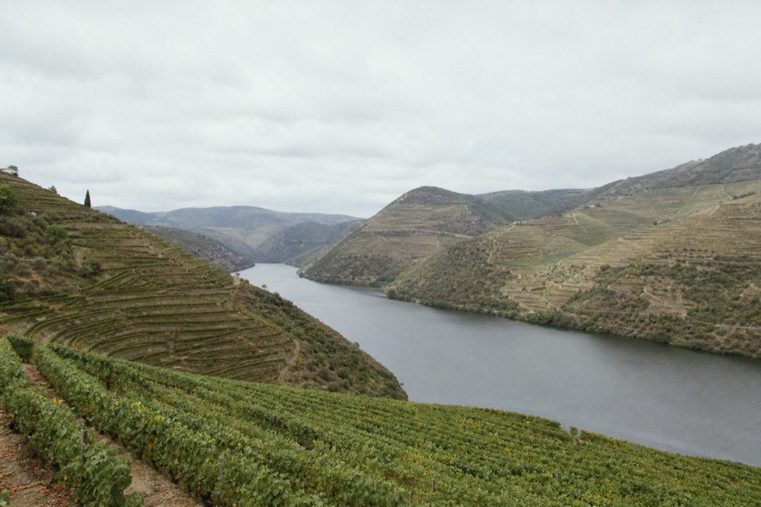
Three, running west to east as the river climbs inland: Baixo Corgo nearest Porto, Cima Corgo in the middle, and Douro Superior stretching to the Spanish border. They get hotter and drier the further east you go.
Baixo Corgo, the lower Corgo, is the coolest and greenest, and its heart is the town of Peso da Régua. Cima Corgo, the upper Corgo, is the largest sub-region and the one most people mean when they picture the Douro; its centre is Pinhão, and the majority of the celebrated quintas sit here. Douro Superior is the wild east, hot and sparse and beautiful, the part almost no day tripper reaches. The map below shows how they stack along the river.
Where Do Régua, Pinhão, Lamego And Tua Sit?
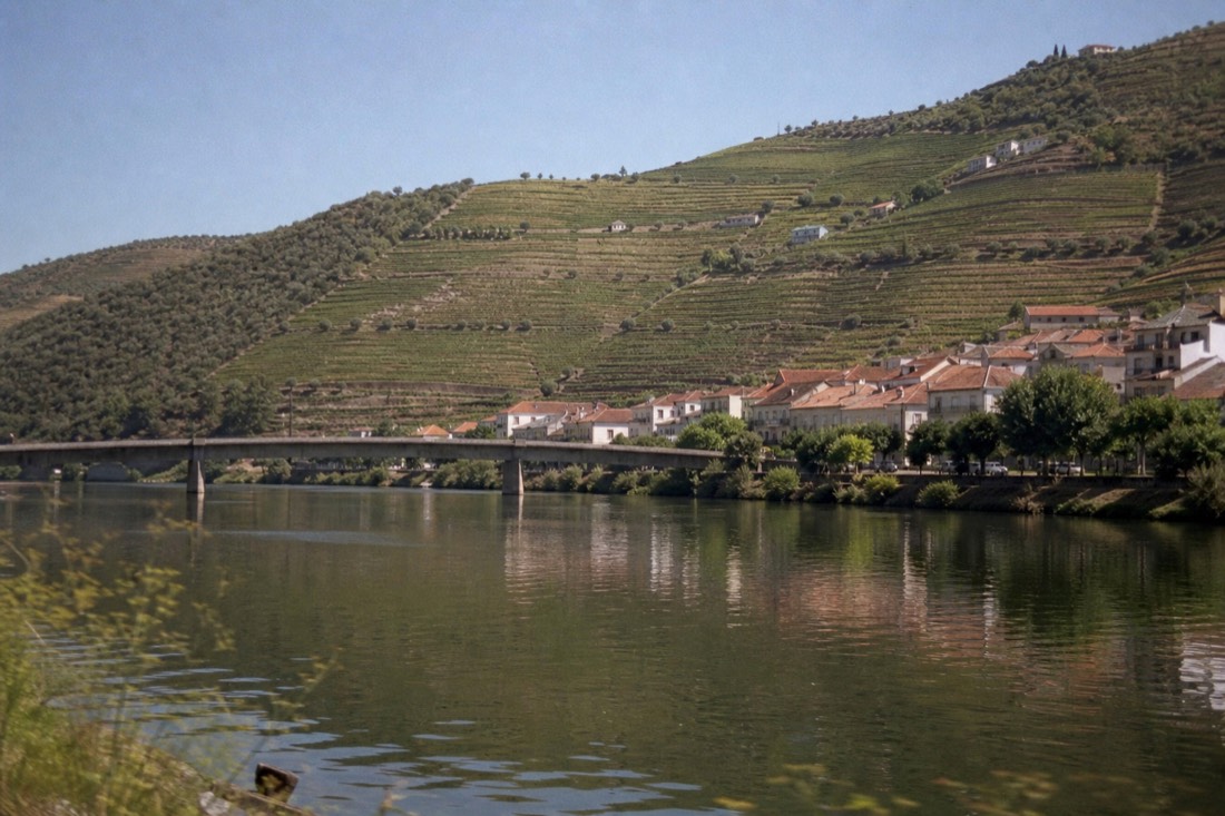
Régua anchors the western Baixo Corgo, Pinhão sits deeper in the Cima Corgo about half an hour further upriver, Lamego is just south of Régua up on a plateau, and Tua lies east of Pinhão where the Tua river meets the Douro.
Régua is the practical hub: the main train station, river cruise docks, and the road junction where most routes into the valley meet. Pinhão is the prettier, more vineyard-wrapped stop half an hour on, at the great amphitheatre bend of the river. Lamego is the odd one out, not on the river at all but ten minutes south and up, a baroque town I cover in the Lamego guide. Tua sits further east, a quiet confluence village that marks roughly where the everyday tourist trail thins out. If you only remember two names, make them Régua and Pinhão.
How Far Is The Douro Valley From Porto?
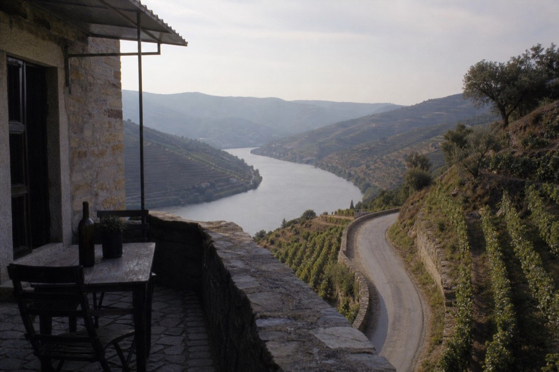
Régua is about 90 minutes by car via the A4 motorway, and Pinhão roughly two hours. The scenic train from Porto Campanhã to Pinhão takes about two hours 20 minutes, following the river for the final stretch.
Those numbers matter because the valley rewards restraint. Trying to reach the Douro Superior and back in a day means most of your day is windscreen, so first-timers should aim for the Baixo Corgo and Cima Corgo and leave the far east for a return trip. The full route-by-route breakdown, car versus train versus bus, lives in the Porto to Douro Valley guide, and the rail option specifically in the train guide. One practical note that the map cannot show you: Portugal's drink-drive limit is low, so if the day includes tastings, someone sober has to do all this driving.
Where Do The Quintas Cluster?
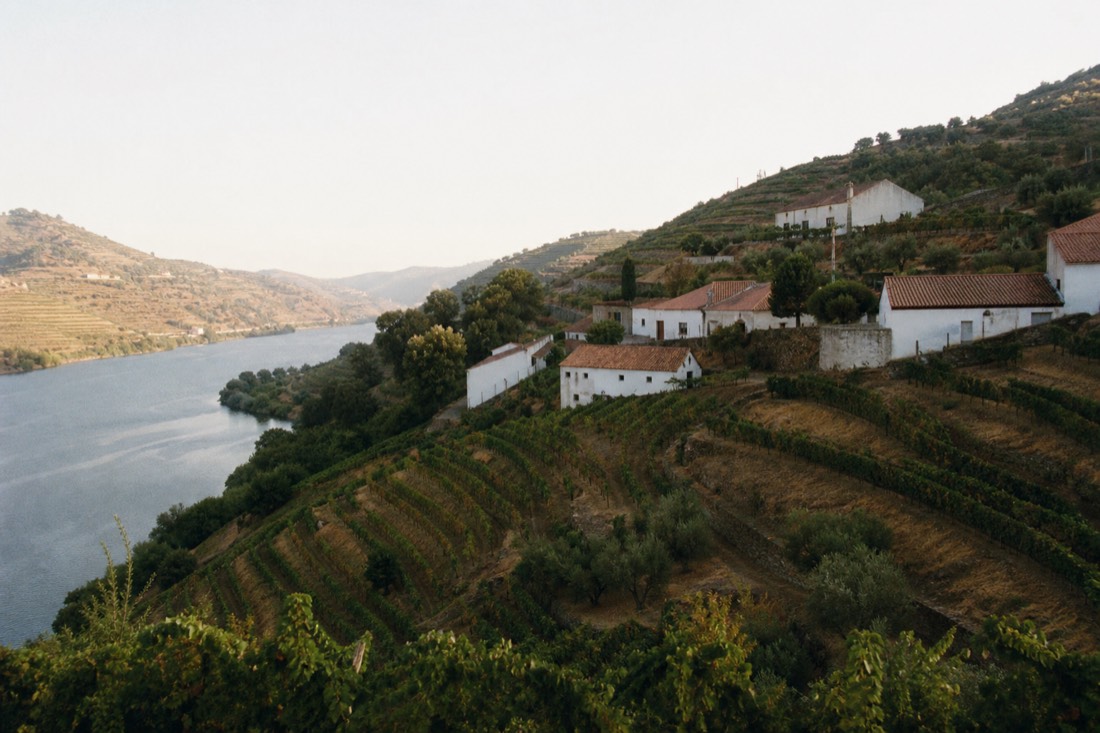
Densest around Pinhão in the Cima Corgo, thinning out in both directions. The steep terraces around the Pinhão bend hold many of the famous names, with a second looser cluster near Régua and a scattering pushing east toward Tua and beyond.
This is the single most useful thing a map teaches you. The postcard density, quinta after quinta stacked up the hillsides, is a Cima Corgo phenomenon centred on Pinhão, which is exactly why the classic day trip points itself there. Around Régua the estates are a little more spread out and the setting flatter, though still lovely and far easier to reach. I break down the individual estates, which welcome walk-ins and which need arrangement, in the best quintas and wineries guide. The short version for planning: base your day on Pinhão if scenery and quinta density are the priority, and on Régua if easy access and logistics matter more.
Reading all of this off a map is one thing; doing the driving between estates on narrow terraced roads while wanting to taste at each is another. The small-group day tour this site features stitches the Cima Corgo highlights together for you, two quinta tastings, a Portuguese lunch and a rabelo cruise at Pinhão, offering a hotel-pickup option for up to eight guests and rated 4.9 across 5,576 combined Viator and Tripadvisor reviews. For a first visit trying to make sense of the geography, letting the operator handle the map is the easy call.
Common Questions About The Douro Valley Layout
Which part of the Douro Valley should a first-timer visit?
The Cima Corgo around Pinhao for scenery and quinta density, or the Baixo Corgo around Regua for easier access. Both are reachable in a day from Porto. Save the remote Douro Superior for a longer stay.
How long is the Douro wine region?
It runs east from near Porto to the Spanish border, well over a hundred kilometres, split into Baixo Corgo, Cima Corgo and Douro Superior. Day trips only ever cover the western two.
Is Régua or Pinhão a better base?
Regua for transport links and practicality, Pinhao for scenery and being surrounded by vineyards. They sit about half an hour apart, so many trips use both.
Your Next Step
Douro Valley Small Group Tour: 2 Wineries, Lunch & River Cruise
Curious where a first valley day actually goes? Explore the winery, lunch and Pinhão cruise itinerary from Porto. Check your travel date before arranging the rest of your visit. Two winery tastings, Portuguese lunch and a Pinhão river cruise from Porto.
9–10 hours; English offered. Central Porto hotel pickup option: up to 8 guests; central meeting option: up to 19. Port and DOC Douro tastings and lunch included; wineries can change. Winery visits and river cruise may include other customers. Gratuities extra; confirm dietary needs and child arrangements before booking.
An initial recommendation, before you make any choices. Confirm the option and restrictions for your party.
Choose your travel date, or open the tour on Viator.
How Will You Reach The Valley?
| Experience | Why Choose It | Allow | What To Account For |
|---|---|---|---|
| Douro Valley Small Group Tour: 2 Wineries, Lunch & River Cruise | Two winery tastings, Portuguese lunch and a Pinhão river cruise from Porto. | 10 hours | 9–10 hours; English offered. Central Porto hotel pickup option: up to 8 guests; central meeting option: up to 19. Port and DOC Douro tastings and lunch included; wineries can change. Winery visits and river cruise may include other customers. Gratuities extra; confirm dietary needs and child arrangements before booking. |
| Douro Valley: Rabelo Boat Tour with Audio Guide | A short boat ride through the vineyard landscape from Pinhão. | 1 hours | 50 minutes; English audio guide app available. Meet and return at Cais A, Pinhão, opposite Praia Bar. Scenic rabelo boat ride; drinks available to buy. No hotel pickup, estate admission or lunch included. |
| Douro Valley & Amarante Wine, Food & Boat Tour from Porto | Douro winery, a cruise with regional tapas, and an Amarante walk and tastings. | 7 hours | 7 hours; English offered. Meet and return at Trindade Domus, Porto. Winery, boat ride, regional food and wine tastings included. Not suitable for reduced mobility; no hotel pickup on the verified meeting-point option. |